The Southern California Ecosystem Services Assessment is a multi-funded, multi-partner, interdisciplinary project assessing ecosystem services across four national forests in southern California. Our goal is to conduct spatial measurements and economic valuation of a suite of ecosystem services that have been identified by resource managers and stakeholders in the region as important: water provision, carbon storage, sediment erosion regulation, recreation and biodiversity services.

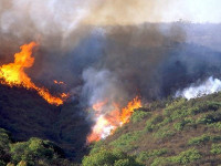
In addition to estimating these ecosystem services under current conditions, we have also developed ways to estimate the impacts of wildfire, climate change, and management actions on some of these services.
To date, no valuations of chaparral-dominated landscapes have been conducted to estimate fire damage or assess the return on investment of management actions, including climate change adaptation. This is particularly important in southern California, which is a global biodiversity hotspot with many large urban areas (and human beneficiaries of ecosystem services) in close proximity to the national forests.
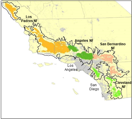
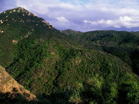
Our study area encompasses 375 watersheds (USGS Hydrologic Unit Code 12) that intersect the four national forests in southern California – the Angeles, Cleveland, Los Padres, and San Bernardino. Overall, the study area covers 35,158 km² (8,687,731 acres) stretching from Monterey County in the north to San Diego County in the south. The area supports a Mediterranean-type climate with cool, wet winters and warm to hot, dry summers, with precipitation decreasing and temperatures increasing from north to south. Shrubland vegetation comprises over half (54%) of the natural vegetation, followed by hardwood and conifer forest (<20%) in higher elevation areas, which rise to 3500 m. National forest lands account for 40% of the study area.
Our outputs are providing the the Angeles, Cleveland, Los Padres, and San Bernardino national forests with data and tools to help manage natural resources and disturbances on the landscape.
The assessment is a collaboration between the University of California-Davis and the US Forest Service Pacific Southwest Program, and involves work with numerous collaborators and funders, including the Forest Service Pacific Southwest Research Station, the US Geological Survey, Michigan State University, CalFire, the National Fish and Wildlife Foundation, the California Landscape Conservation Partnership Program, the US Forest Service Western Wildland Environmental Threat Assessment Center, US Forest Service Geospatial Technology and Applications Center, and the National Park Service Santa Monica Mountains National Recreation Area.
Image credits throughout website: Richard Halsey, Nicole Molinari, Hugh Safford, Emma Underwood, and Ramon Vallejo,